CHF 14.15
Sofort lieferbar Bestpreis-Garantie Versandkostenfrei 40 Tage Rückgabe
Sofort lieferbar 40 Tage Rückgabe
CHF 14.15
Produktinformationen
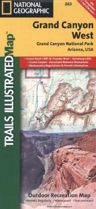
Komplett neudesigned, verbesserter Maßstab und Infos zu den meistbesuchten Touristenattraktionen
National Geographic's Trails Illustrated Maps are the most detailed and up-to-date topographic recreation maps available for US National Parks, National Forests and other popular outdoor recreation areas. A necessity for exploring the outdoors, each map is printed on waterproof, tear-resistant material. They also contain key safety and contact information, GPS and compass coordinates, Leave No Trace ethical guidelines and hundreds of points-of-interest, including scenic viewpoints, campgrounds, boat launches, swimming areas, marine sanctuaries and wildlife refuges.
National Geographic's Trails Illustrated Maps are the most detailed and up-to-date topographic recreation maps available for US National Parks, National Forests and other popular outdoor recreation areas. A necessity for exploring the outdoors, each map is printed on waterproof, tear-resistant material. They also contain key safety and contact information, GPS and compass coordinates, Leave No Trace ethical guidelines and hundreds of points-of-interest, including scenic viewpoints, campgrounds, boat launches, swimming areas, marine sanctuaries and wildlife refuges.
| Jahr | 2013 |
| Format | pa_format_0 |
| Sprache | Englisch |
| Gewicht (g) | 96 |
| Breite (mm) | 99 |
| Höhe (mm) | 3 |
| Länge (mm) | 236 |
| Verlag | National Geographic Maps |